
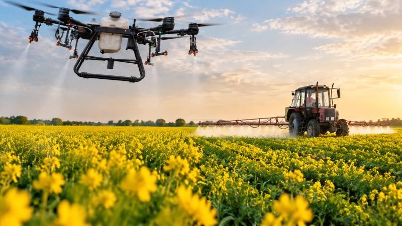
Farming is changing rapidly. From satellite imagery to artificial intelligence, modern technology is giving farmers new ways to understand what is happening across their fields. Among the most promising tools are agricultural drones.
For Pakistani farmers, drones can provide a faster and more detailed view of crops than traditional field inspections. A drone equipped with a high-resolution camera or specialized sensors can survey fields, identify crop stress, monitor irrigation, detect pests and diseases, and support precision spraying.
Pakistan’s agriculture sector faces challenges including water management, input costs, labor availability, and low productivity. Research on Pakistan’s agricultural technology landscape identifies precision agriculture, drones, robotics, IoT, and data-driven farming as potential tools for improving farm management.
So, how can drones actually help farmers in Pakistan?
1. Faster Crop Monitoring
Walking through a large farm to inspect every crop can take considerable time. A drone can cover large areas quickly and capture aerial images that reveal differences across a field.
Farmers can use drone imagery to monitor:
- Crop growth
- Plant density
- Missing plants
- Water stress
- Nutrient deficiencies
- Pest damage
- Disease symptoms
- Weed distribution
Agricultural research shows that drone-based remote sensing can provide high-resolution information and help farmers identify crop problems earlier than conventional visual inspection.
This can help transform farming from reactive management to data-driven decision-making.
2. Detecting Crop Diseases and Pests
A major advantage of agricultural drones is their ability to inspect crops from above.
With suitable cameras and sensors, drones can identify unusual vegetation patterns associated with pest infestations, disease, nutrient deficiencies, or plant stress.
Instead of treating an entire field immediately, farmers can use drone maps to locate areas that require closer inspection.
This approach supports precision agriculture, where farmers apply resources according to actual field conditions rather than treating every section equally.
Researchers in Pakistan have also explored intelligent agricultural drones for pesticide spraying and agricultural monitoring.
3. Precision Pesticide Spraying
Drone spraying could become one of the most valuable applications for Pakistani agriculture.
Traditional spraying often requires workers, tractors, or other machinery to distribute pesticides across a field. Agricultural drones can carry spraying equipment and apply chemicals to targeted areas.
Advanced systems can combine cameras, artificial intelligence, and prescription maps to identify areas requiring treatment and adjust application accordingly. Recent research from NUST, for example, describes an AI- and IoT-enabled smart spraying system designed around variable-rate application and targeted pest control.
The goal is simple:
Put the right amount of agricultural input in the right place at the right time.
This can potentially reduce chemical waste, labor requirements, and unnecessary applications when the system is properly calibrated and operated.
4. Better Irrigation Management
Water is critical to Pakistani agriculture, particularly in areas facing increasing pressure on water resources.
Drones can help farmers identify sections of a field that appear unusually dry or stressed. Thermal and multispectral sensors can provide additional information about plant water status and vegetation condition.
Farmers can then combine drone data with soil-moisture sensors, irrigation schedules, weather information, and field observations to improve water management.
Drones do not replace irrigation systems, but they can help answer an important question:
Which parts of my field actually need attention?
5. Field Mapping and Land Management
Before planting, farmers need to understand their land.
Drone-based aerial surveys can create detailed maps showing field boundaries, elevation differences, drainage patterns, crop zones, and other characteristics.
These maps can support:
- Land surveying
- Field planning
- Drainage management
- Crop mapping
- Irrigation planning
- Farm infrastructure planning
- Yield analysis
High-resolution drone imagery is particularly useful because it can provide detailed information at field level rather than relying only on broader satellite imagery.
6. Monitoring Crop Growth
Farmers can fly drones over fields at different stages of the growing season and compare images over time.
This creates a visual record of crop development.
With suitable sensors and analytical software, drone imagery can help estimate indicators such as plant health, vegetation vigor, canopy development, and biomass.
Research on UAV-based precision agriculture has identified crop scouting, yield monitoring, plant stress detection, disease classification, weed detection, and nutrient assessment among the important agricultural applications of drones.
7. Supporting Fertilizer Management
Applying too much fertilizer increases costs and may contribute to environmental problems, while applying too little can limit crop performance.
Drone imagery can help identify variations in crop vigor across a field. Farmers can combine this information with soil tests and agronomic recommendations to develop more targeted nutrient-management strategies.
This is an important part of site-specific farming and variable-rate agriculture.
The drone does not decide the fertilizer requirement by itself. Instead, it provides valuable field information that farmers and agricultural specialists can use alongside soil and crop data.
8. Helping Small and Large Farms
Drones are often associated with large commercial farms, but the technology can potentially support smaller farms through drone service providers.
A farmer does not necessarily need to purchase an expensive drone.
Instead, farmers could pay a trained operator to:
- Survey the field
- Capture aerial imagery
- Analyze crop conditions
- Produce a field map
- Identify problem zones
- Provide recommendations for further inspection or treatment
This service-based model could make precision farming technology more accessible to farmers who cannot justify purchasing and maintaining their own equipment.
Challenges of Agricultural Drones in Pakistan
Drones offer exciting opportunities, but they are not a magic solution.
Farmers may face challenges involving:
- Initial equipment costs
- Battery life
- Operator training
- Weather conditions
- Data analysis
- Maintenance
- Internet and digital infrastructure
- Regulatory requirements
- Safe pesticide application
Research focused on Pakistan highlights limited technical training, digital infrastructure, affordability, and difficulty interpreting agricultural data as barriers to wider adoption of precision technologies.
Farmers therefore need more than hardware. They need training, reliable technical support, useful software, and practical agricultural advice.
The Future of Drone Farming in Pakistan
The future could go beyond simple aerial photography.
The combination of drones + artificial intelligence + remote sensing + IoT + GPS + farm management software could create increasingly intelligent farming systems.
A drone could identify a crop-health problem, create a digital field map, and help generate a targeted management plan. Farmers could then use that information to make decisions about irrigation, fertilizer, pest control, and crop monitoring.
Pakistan already has research activity in this area. LUMS, for example, has been developing locally relevant, low-cost drone and AI solutions focused on crop-health assessment, yield prediction, and plant monitoring.
Are Drones Worth It for Pakistani Farmers?
For farmers managing valuable crops, large fields, difficult terrain, or intensive production systems, drones can provide valuable information that traditional monitoring may miss.
But farmers should calculate the return on investment before purchasing equipment.
A practical starting point is often to use a professional drone service for one or more fields and compare the results with conventional scouting.
The important question is not simply whether a drone looks impressive.
The real question is:
Can the information it provides help a farmer save water, reduce unnecessary inputs, detect problems earlier, improve productivity, or make better decisions?
Final Thoughts
Agricultural drones can become an important part of Pakistan’s smart farming future.
From crop monitoring and disease detection to precision spraying, irrigation management, field mapping, and yield assessment, UAV technology can give farmers a clearer picture of their fields.
For Pakistani agriculture, the greatest opportunity may come from combining drones with AI, satellite data, IoT sensors, soil testing, weather information, and experienced agronomic knowledge.
The future of farming will not depend on technology alone. It will depend on using technology intelligently to help farmers produce more efficiently, conserve resources, reduce unnecessary costs, and build more resilient farms.
For farmers exploring the next generation of agriculture, drones may be one of the tools that turns the farm from a field of uncertainty into a data-driven production system.